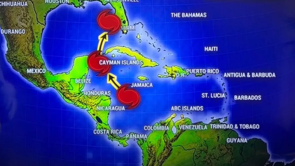
Weather experts are monitoring Hurricane Sara, which is expected to form into a tropical storm soon and could potentially head toward the Gulf and hit Florida. This was forecast last week, but the risk of development has increased significantly since then. The hurricane season for 2024 has been quite long, though fortunately Hurricane Rafael largely missed the United States as it curled back toward Mexico. But some models project that we may not be so lucky for the next named storm in November 2024.
When will Tropical Storm or Hurricane Sara develop?
Sara is predicted to form into a tropical depression and then a hurricane by this weekend, Friday at the earliest, according to several models.

As explained by Brian Shields, otherwise known as Mr. Weatherman on YouTube, on November 12, a cluster of scattered showers and storms in the eastern Caribbean Sea will drift toward the west over the course of the week. Four models (American, European, Canadian CMC, and ICON) highly predict that this system will eventually develop into a tropical depression some time during the weekend. If that happens, it will be called Sara officially.
Additionally, a November 12 report from the National Hurricane Center says that the chance of a named storm to develop as predicted is at 80 percent through the next seven days. Accuweather believes that there is also a high risk of storm development in the region between November 14 and November 18. The Caribbean Sea is still conducive to storm formation this late in the hurricane season due to low wind shear and high moisture.
At that point, the American model predicts that by next week, Hurricane Sara will move north toward the left of Cuba and then curl toward Florida. The European model, though, says that it will curl more sharply back to Cuba like a boomerang. That said, as we’ve seen with Hurricane Rafael last week, the path of storms can change wildly from day to day. We’ll be tracking this storm carefully as it continues to develop.


